
Rock and Heather
/Rock and Heather
Hutch aimed Rosehearty's bow at Qeqertasussuk Island. Low cloud and light rain obscured the coastline.
"It's called smur," Hutch said.
"What is?" I asked.
"Drizzle with fog is called ' smur' in Scotland. That's the noun but you can also use it as an adjective and say 'smurry'".
"In Na Zelan we call it 'sput', chimed in Kiwi Mark. "You can say 'it's sputting'. That means light rain, you know, sput."
The British Admiralty pilot states rather stoically, "Tidal Streams set strongly across the approach to the Kangerlussuaq Fjord entrance. They can attain a rate of 7 knots in the vicinity of Qeqertasussuk Island."
The day before we had scoured our tide Atlases on board as well as the internet for nearby tide stations. Ultimately, the Arctic Command Center with whom we are required to communicate every 6 hours, provided tide times and heights for a point very close to Qeqertasussuk Island. Our goal was to be at the entrance 3 hours after the morning's low water, in order to find slack water for the transit into the fjord. The approach is from the east with submerged rocks and shallows to the north and south. The abundance of smur was not helping.
Kangerlussuaq Fjord is the largest fjord in western Greenland, originating at the Qinnguata Kuussua river estuary and terminating a staggering 120 miles later in the waters of Davis Strait. Kangerlussuaq is deep (more than 100 meters in many places), wide (up to 5 miles) and lined with mountains reaching 1500 meters into the sky. The waters close to Davis Strait are blue-black but further up the fjord, alluvial sediments from the Qinnguata Kuussua river transform the water to an eerie, unreadable emerald green. At the very head of the fjord, the water turns cappuccino brown. Depth transducers work intermittently, often flashing spurious readings.
About 2 miles out, the smur lifted and we began to catch glimpses of the hidden land, layered, stretching from the sea towards the heart of the country. "Now that is looking better," said Hugo, who had been watching the rain with consternation during the previous watch. Misty cloud decorated the higher peaks, the land appeared dark. We approached on the leading transits pointed out in the sailing directions -- 099 True towards a range on the southern tip of Qeqertasussuk Island, until a second range came in to view bearing 056 on the northern end. We held 056 for 1 mile and then turned 25 degrees to starboard and in to the middle of the fjord. The tidal information provided by Arctic Command was accurate; we glided in with very little current, the two diesel engines pushing Rosehearty effortlessly out of the turbulent waters of Davis Strait in to the protected waters of Kangerlussiaq. Markus watched the range beacons with binoculars. Hutch had the helm, referring to the two independent electronic chart systems that were running. I relayed depth information from the wheelhouse. The engineering team monitored critical systems and equipment.
For the next 7 hours we rumbled north in flat water, the panorama of the gorge gliding passed. The guests admired the surroundings over breakfast, attended to by Renee, Catherine and Lenka. Hugo sprinted for vinegar, a shammy and a squeegee. "You've got to have clean windows for these views!" Not a smudge or smear survived Hugo's vinegar spritz and deftly guided blade.
Steep cliffs, riddled with black striations gave way to rounder hills, carpeted in pockets with verdant ground cover. We dropped anchor on a narrow shelf with usable depths. About two miles from the top of the fjord we spied a rocky beach on which we could land a tender. An expedition was quickly organized. Wolfie, our orange RIB, crunched ashore on a pink gravel beach. A lush valley rose at a slight incline towards smooth hills. "Keep an eye out for Arctic hare and fox," said Ken looking around, "This is perfect hare habitat."
Our walk to the upper ridge brought us through lush Arctic flora. "Coming from Devon Island and the places we visited much further north," said Simon, "really amplifies how lush this landscape is. It would feel different if we hadn't been north first ." Juniper, wild flower, and soft grasses covered the land like a patchwork quilt. The ground was soft, loamy, giving way under our boots. Russet reds, rich yellows, and vibrant pinks contrasted with black, lichen-smeared rock. Paul spied several white dots; the hare were here for sure. Unlike those we saw near Arctic Bay which sported mottled gray summer coats, these hare were snow white and easily visible from a distance. Ken bent down and picked something up: "Fox," he said, handing me a small narrow skull, picked clean, but still with sharp fangs intact. Paul and Nadia explored on their own and had up close encounters with some brave hare. They also found a reindeer skull, complete with antlers. There was no wind. It was very quiet, except for the hushed timbre of raindrops hitting our jackets.
Our group spread out. This was to be our last day above the Arctic circle. From here, the owners and their guests will depart. Our journey by sea will carry us south, towards shorter days, warmer nights, away from Greenland across the Atlantic ocean to the Mediterranean. On a high, flat promontory, with a commanding view of the rich Arctic carpet stretching down to the waters of Kangerlussiaq Fjord, I decided to build my Inuksuk. I chose 7 stones, one for each of the lessons we learned in the far north. But that will be the subject for another day.
--Jonathan
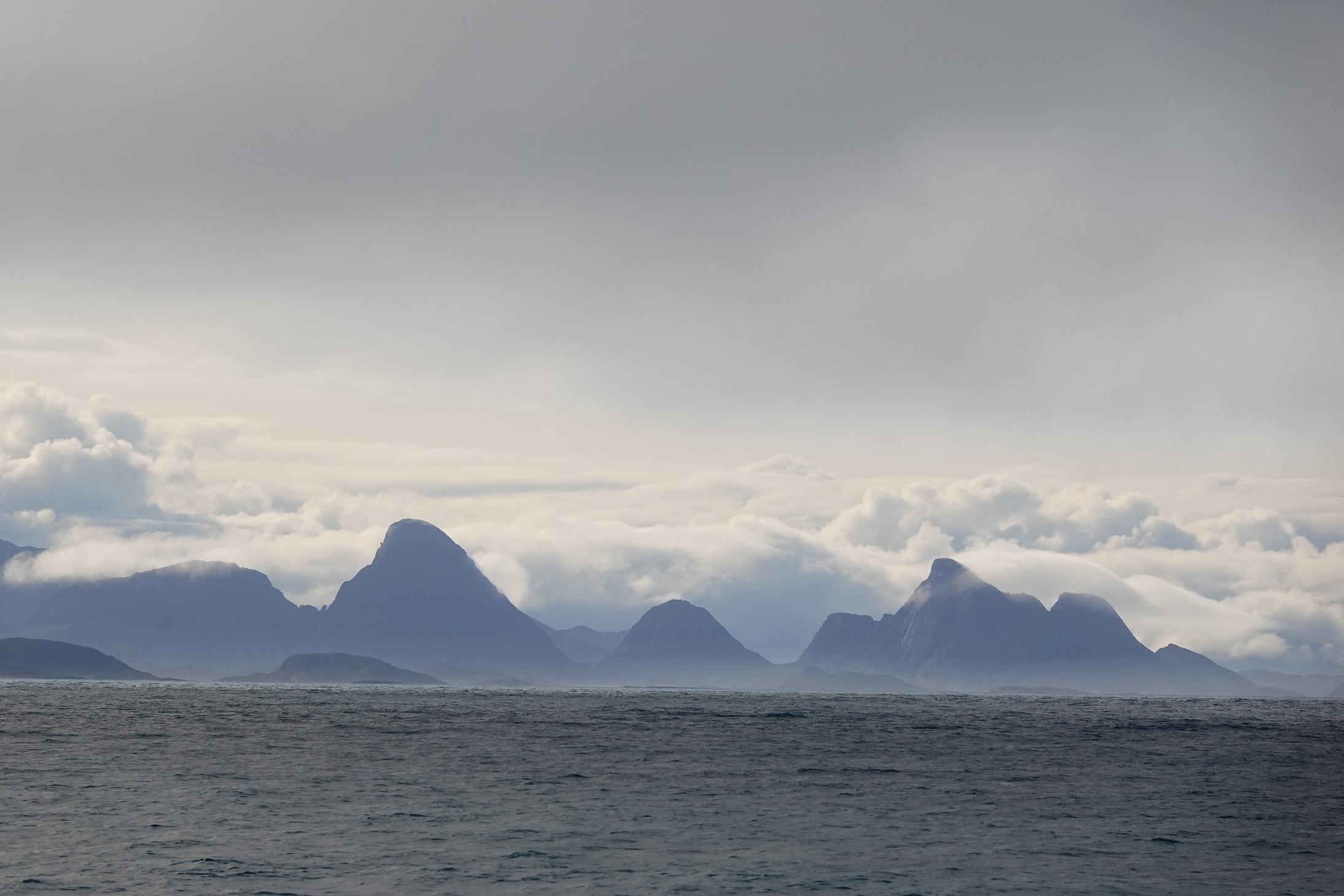
Photo by Hugo

Photo by Hugo
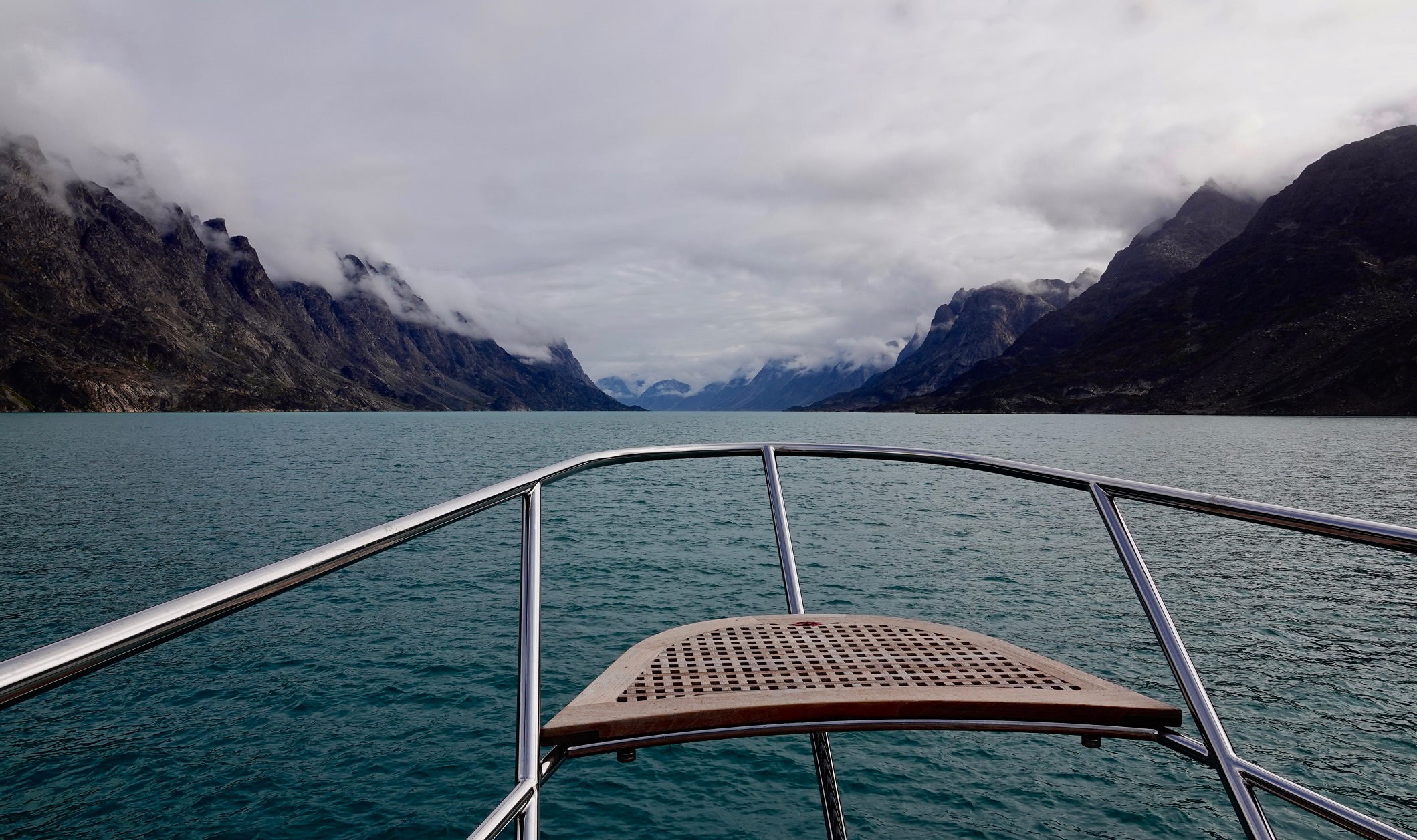
Photo by Hugo
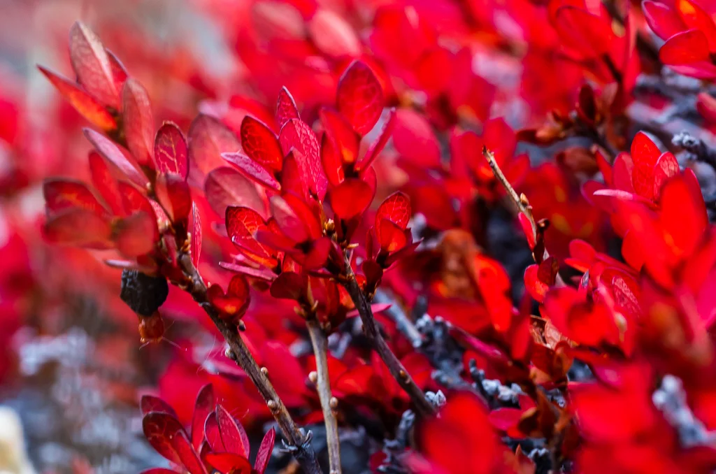
Photo by Ken Burton

Photo by Ken Burton

Photo by Ken Burton

Photo by Ken Burton

Photo by Ken Burton

Photo by Jonathan

Photo by Ken Burton